Wednesday, September 12, 2018 7:13:36 AM
Iconic Rocks Jutting Out of the San Rafael Swell
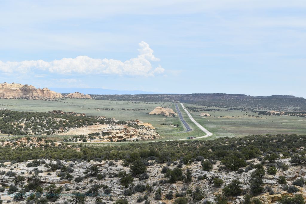
Travelling either east or west on the Interstate 70 between
Salina and Green River in central Utah you will come across a couple of
pinnacles jutting out of the high plateau of the San Rafael Swell.
It's the San
Rafael Swell that is responsible for creating the Ghost Rocks and the
I-70 freeway cuts right through the swell from near the Freemont
Junction almost to Green River. The I-70 ascends Ghost Rock Summit,
which is the highest point of the I-70 freeway inside the San Rafael
Swell and also where we find the Ghost Rocks themselves. At the summit
is there truck rest area and a viewing area overlooking the Little Grand
Canyon of the San Rafael River. The Ghost Rock Summit is named for the 2
unusual Ghost Rock formations nearby.
 The above map shows the I-70 as it traverses the San Rafael Swell
with the the approximate location of the Ghost Rocks indicated by
the red teardrop.
The above map shows the I-70 as it traverses the San Rafael Swell
with the the approximate location of the Ghost Rocks indicated by
the red teardrop.
 This is Ghost Rock West as from seen from the rest stop on the eastbound side of
the I-70. The direction of the photo is North West at 320 magnetic
north. This west rock is not as easily accessed as the east rock.
This is Ghost Rock West as from seen from the rest stop on the eastbound side of
the I-70. The direction of the photo is North West at 320 magnetic
north. This west rock is not as easily accessed as the east rock.
Called the "Ghost Rocks" as there are actually 2 separated
pinnacles one being Ghost Rock West and the other naturally Ghost Rock
East. The naming of these 2 pinnacle features is buried within folklore.
Most stories relate to a cowboys looking for cattle who came across
these features then paused for a minute as the early-morning fog
shrouded the base of the peaks so that all the cowboys could see were
the pinnacles protruding above the fog base, which made the cowboys
think of ghost-like figures floating in the air.
But also note
that the rocks are primarily white in color just like Casper the Ghost.
Not that I am saying that the average cowboy of the late 1800's read
comic books about a "friendly ghost" but the term "ghostly white" makes
one wonder if that might be a more relevant term.
 Ghost Rock East from the rest stop on the I-70 Eastbound. It was
June and rain showers moving about. Ghost Rock East has a much more
of a narrow top at the crest than that of Ghost Rock West.
Ghost Rock East from the rest stop on the I-70 Eastbound. It was
June and rain showers moving about. Ghost Rock East has a much more
of a narrow top at the crest than that of Ghost Rock West.
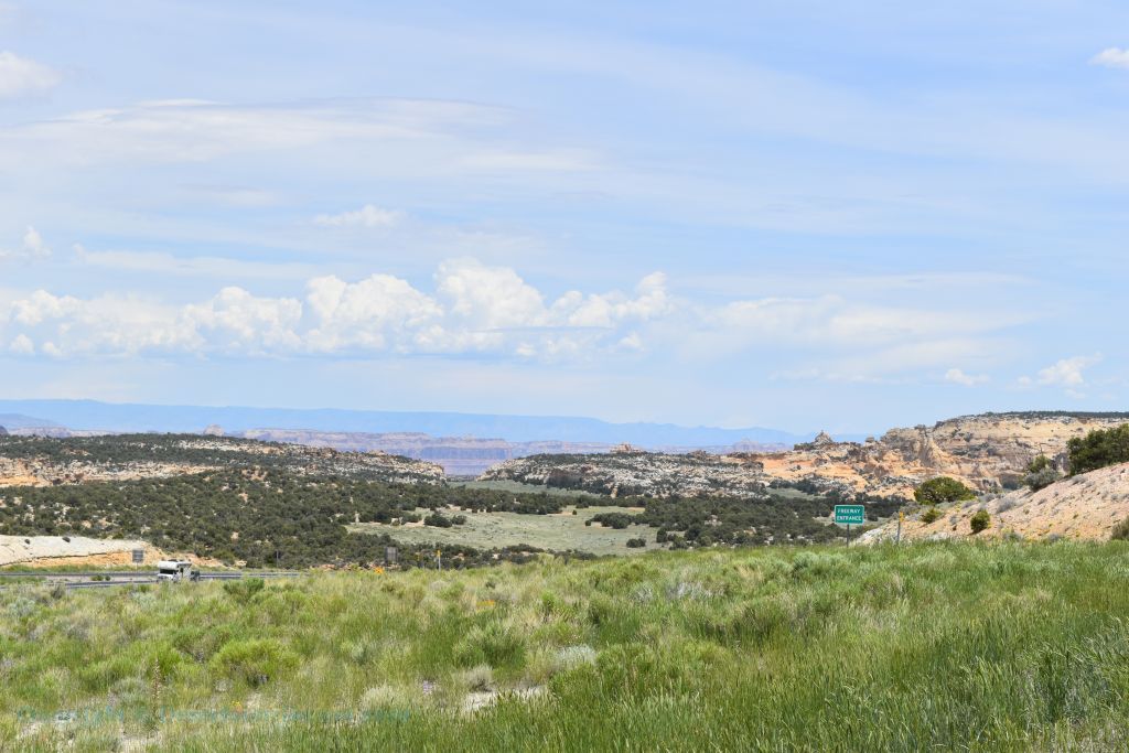
Anyhow these rocky pinnacles were viewable for many decades only to a few locals
as this area of central Utah was extremely remote up until the
construction of Interstate freeway system. The Utah portion of the
Interstate 70
was not completed until 1970 making the I-70 one of the last major segments of the Interstate freeway
system to be completed. The Colorado portion of the I-70 is the very
last portion of the Interstate system. This is through Glenwood Canyon
and that segment was not completed until October 14, 1992.
When the plans for I-70 were finally made,
the route of the freeway would be right across the San Rafael Swell. At
that time (late 1960's) the area west of Green River was still so remote
that the survey crews had to use 4 x 4 jeeps to survey parts of the
route and in the process came across herds of wild Mustangs. No! Not the
Ford auto but 4-legged wild horse variety.
To get a better idea of how
remote the area was in the late 60's/early 70's a story has come out
that during the highway's dedication ceremony (as told by an engineer
who surveyed the highway), that when a group of engineers was approached
by a sheep rancher and he asked what they were doing. The rancher then
had a ROFL moment when it was explained that they were building a
freeway. What the sheep rancher did not understand was that this freeway
would change the local people’s way of life mostly for the worse.
 Above we have a satellite image of both Ghost Rocks (via Google
Maps)
Above we have a satellite image of both Ghost Rocks (via Google
Maps)

 Above left is a satellite image of Ghost Rock West and on the
right is a satellite image Ghost Rock East. (both via Google Maps)
Above left is a satellite image of Ghost Rock West and on the
right is a satellite image Ghost Rock East. (both via Google Maps)
So, in 2002, the mayor of Richfield, Utah was interviewed by the
Salt Lake Tribune newspaper about what changes they had I-70 brought to
the Sevier Valley. Previous to the completion of the I-70 these were
isolated farming/ranching communities, whose residents were unaccustomed
to the crime and other detrimental effects that a transcontinental
highway can bring. The residents of Richfield, Utah soon started to
refer to the I-70 as the "Cocaine Lane". In the interview the mayor of
Richfield stated that the I-70 is a mixed blessing. He stated that the
Interstate 70 is a boon to the hospitality industry and has made
Richfield more accessible to other cities within and outside of Utah.
However, the new Interstate 70 has brought types of crime previously not
known to our city.
A major change in the rural lifestyle of this
central Utah area came about after the completion of I-70, when many
residents started to lock their doors for the first time. An interview with mayor of Richfield
resulted from an event that served as a horrible "wake-up call" for the
residents of peaceful rural Utah in that they were "no longer isolated
from crime". In Richfield a panic soon ensued after the citizens
witnessed Utah Highway Patrol troopers arresting a suspect and removing
him in handcuffs, then removing plastic bags and ice chests full of body
parts from the trunk of his car. The body parts were of a woman, later a
dead male was also found hidden in the trunk, he was still intact. This event caused a mini
frenzy of people checking on their neighbors to be sure that their
neighbors were not one of the victims.
Metro crime (Las Vegas,
Los Angeles, San Francisco and so on) now can easily move along the
interstate freeway freely into the small towns and villages of rural
Utah. Even the Ghost Rocks are not free from this metropolitan urban
filth. The Ghost Rocks now have that urban graffiti signature of
stupidity!
Both of the Ghost Rock formations stand
out from the remainder of the mountains and mesas nearby. The Ghost
Rocks themselves are listed as being at 7,420 feet (2,262 m) at the top
of the rocks (Ghost Rock West). For Ghost Rock East from the rest area
parking lot my GPS registered 2066 meters (6,772 feet) elevation while
at the top of the rest area just under the base of Ghost Rock East my
GPS registered 2221 meters (7,287 feet). That makes Ghost Rock East
around 230 feet tall from the base but due to the rocks shape and color
it stands out well among all the other peaks in the immediate area.
I guess that climbing the rocks is allowed as I did not see any
signs stating that climbing was prohibited. I am completely against this
lame naive idea as both of the rock formations are too easily accessible
to a vast amount of motoring human traffic due to the I-70's 2 rest
stops on either side of the freeway. A constant flow of human climbers
will cause undue damage to the rock formations.
The material that
makes up most of the Ghost Rocks formations is Navajo Sandstone. And
before some fellow yells at me that all Navajo Sandstone is reddish,
read below.
Direct from Wikipedia:The wide range of
colors exhibited by the Navajo Sandstone reflect a long history of
alteration by groundwater and other subsurface fluids over the last 190
million years. The different colors, except for white, are caused by the
presence of varying mixtures and amounts of hematite, goethite, and
limonite filling the pore space within the quartz sand comprising the
Navajo Sandstone. The iron in these strata originally arrived via the
erosion of iron-bearing silicate minerals.
Initially, this iron
accumulated as iron-oxide coatings, which formed slowly after the sand
had been deposited. Later, after having been deeply buried, reducing
fluids composed of water and hydrocarbons flowed through the thick red
sand which once comprised the Navajo Sandstone. The dissolution of the
iron coatings by the reducing fluids bleached large volumes of the
Navajo Sandstone a brilliant white.
|
Soft:
|
Medium:
|
Hard:
|
Very Hard:
|
|
Talc
Slate
Gypsum rock
Asbestos rock
Soft limestone
|
Limestone
Dolomite
Sandstone
Copper Ore
|
Granite
Quartzite
Iron ore
Trap rock
Gravel
Gabro
|
Iron ore (Taconite)
Granite
Grantic gravel
Trap rock
|
So why is rock climbing on these 2 features such a stupid idea?
Think about this; the Interstate
freeway (I-70) brings tens of thousands of visitors weekly by these 2
pinnacles and if even only a few out of these thousands of visitors
actually climb the rocks you still can have up a possible 100,000
climbers shredding these 2 peaks. Sandstone is not a hard rock. Read the
quote below from www.canyoneeringusa.com:
"Sandstone is held
together by impurities such as clay and lime that are deposited with the
sand. Navajo lacks these impurities and thus is poorly held together.
The rock is weak and often crumbly, but still forms huge cliffs. The
rock near the top is especially pure, white and weak, partly because it
was deposited as pure sand, and partly because rainwater, over tens of
thousands of years, has dissolved what little binding material was
available and carried it down through the rock to the lower layers".
When visiting this road side stop in the middle of June rain showers
were popping up all around the San Rafael Swell even though the
temperature was hovering around 96°. The higher altitude of the San
Rafael Swell at around 7,000 feet in elevation makes this area a zone of
high plant endemism, with many native plants being endemic to the swell
and not occurring anywhere else in the world.
The San Rafael
Swell is a beautiful place to hike, picnic and shoot photos but everyone
should be reminded to beware of the Biological Soil Crust!
The San Rafael
Swell is part of the Colorado Plateau and is full of this clumpy,
blackened soil. This soil is extremely important to the health of the
high desert areas of Utah, Arizona and Colorado.
Direct from the National Park Service:
Biological soil crust is just what the name describes – a living
soil that creates a crust over the landscape. Biological soil crust is
found throughout the world, from the Colorado Plateau’s high desert to
the arctic! In many places, soil crust comprises over 70 percent of all
living ground cover. The knobby, black crust here includes lichen,
mosses, green algae, micro fungi, and bacteria, but is dominated by
cyanobacteria.
Biological soil crust has helped shape today's
high desert. Soil crust helps control erosion by keeping soil stuck
together in one continuous crust. Sediment doesn’t wash away in the rain
or blow away in the wind. This is why the Colorado Plateau’s high desert
isn’t covered in loose sandy dunes.
Soil crust also holds and
retains water. Plant roots tap into this spongy crust to survive dryer
and hotter conditions. It also promotes plant life by taking nitrogen
from the air and changing it to a kind of nitrogen plants need.
Without these effects, animals, and even humans, would not be able to
survive well in the desert.
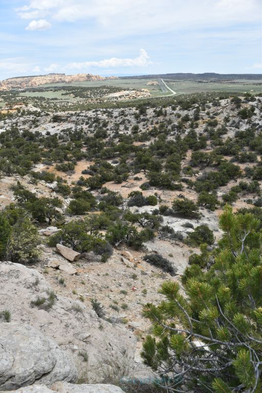
There is much more to see than just
the two jutting rocks. You can walk or drive to the back side of Ghost
Rock East to examine a view of the cliffs to the east.

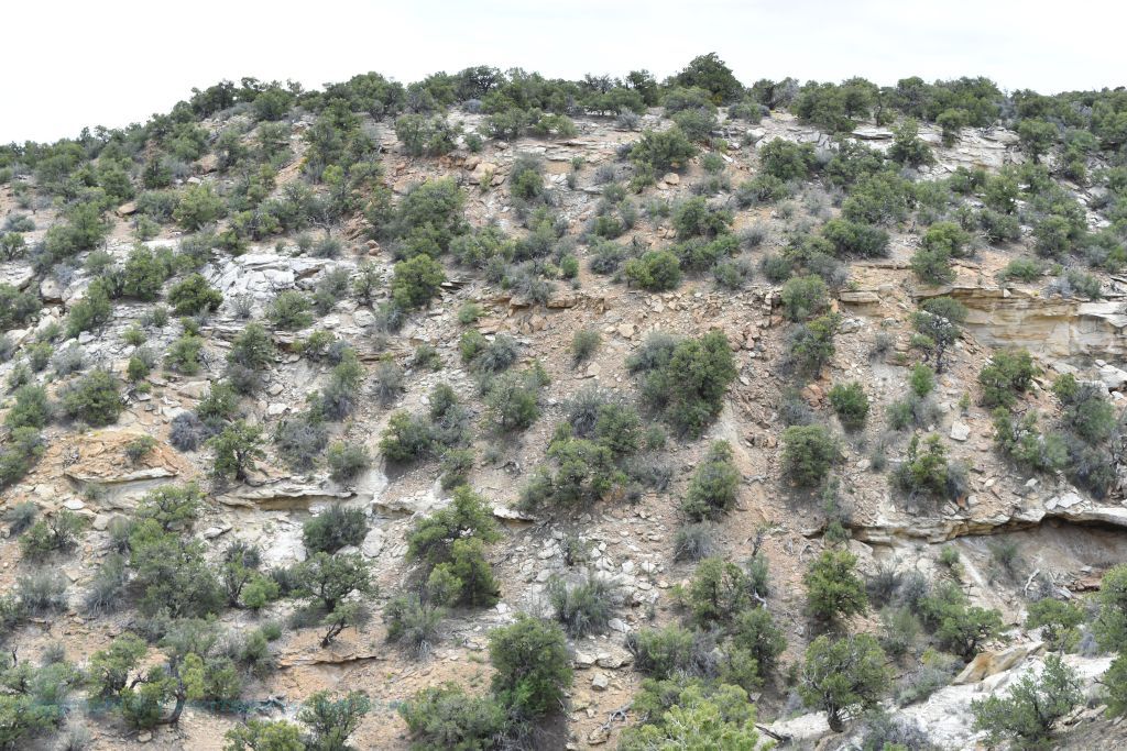
The satellite image above this photo shows the approximate location
and direction of the photo directly above. It is interesting for 2
reasons.
1. You can see clearly the weathering of the hillside with the
sandstone ridges breaking apart. Wind and especially rain have an
adverse effect on sandstone.
2. Beyond the immediate hill to the
east is an escarpment leading to a valley below. I saw a number of trails that
can be easily hiked down through escarpment to the valley below.
But alas a thunderstorm was brewing up directly over the Ghost Rocks
area and I was dressed for 100°
weather! No trail hiking this afternoon. Only time enough for a few more
photographs and then back to the Interstate 70 east to Arches National
Park.
The view from the rest stop parking lot was just fine. The urge to climb
just the bottom portion of Ghost Rock East to receive a better sweeping
view was met by even a greater urge to preserve what little nature we
have left in this nation.
 The Manti-La Sal National Forest about 55 miles North East
from the Ghost Rock Rest Area, Utah. Yes it's the middle of June
and those mountains are snow capped.
The Manti-La Sal National Forest about 55 miles North East
from the Ghost Rock Rest Area, Utah. Yes it's the middle of June
and those mountains are snow capped.

The Wasatch Platea within the
Manti-La Sal National Forest
has a peak that is 11,877 feet (3,620 metres) tall.
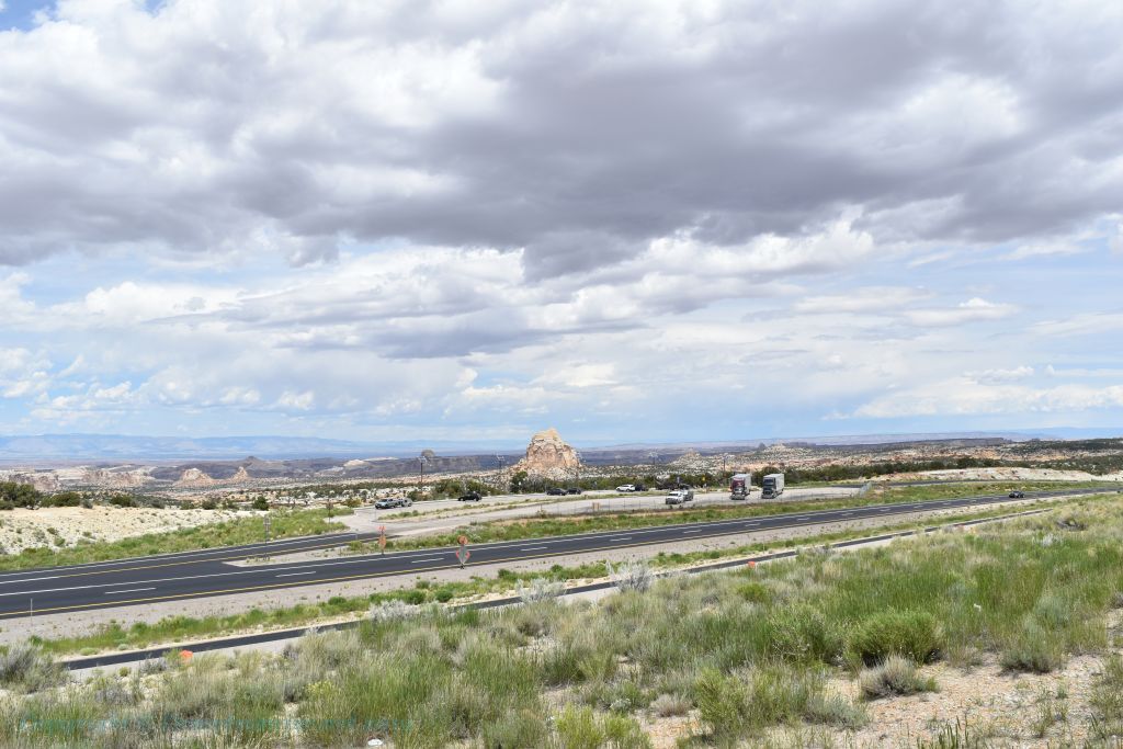
Looking eastward at the I-70.

Both images are viewing in a north eastward direction.
This view I believe is toward Horseshoe Bend in the distance
with Locomotive Point to the Left.
Sometimes a "rest stop" can become a photo stop!
Bibliography
https://en.wikipedia.org/wiki/San_Rafael_Swell
https://www.nationalgeographic.com/science/earth/the-dynamic-earth/weathering-erosion/
https://en.wikipedia.org/wiki/Interstate_70_in_Utah
https://www.deseret.com/2002/3/16/19643600/driver-charged-with-murder
https://eq.uen.org
https://www.canyoneeringusa.com/zion/geology
https://ugspub.nr.utah.gov/publications/geologicmaps/30x60quadrangles/m-242.pdf
https://www.canyoneeringusa.com/zion/geology
https://www.rockbreaker.com/equipment/breakers
https://www.inaturalist.org/check_lists
https://www.nps.gov/articles/seug-soil-crust.htm
https://www.gomoab.com/moab_environment.html